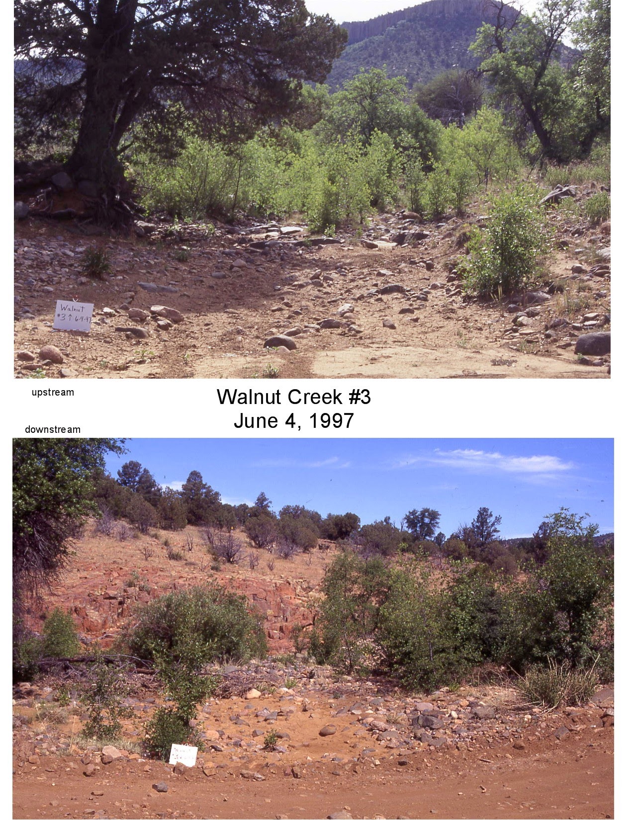
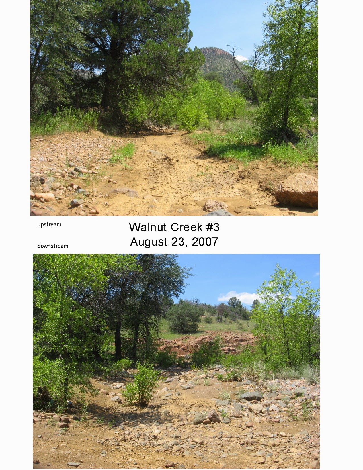
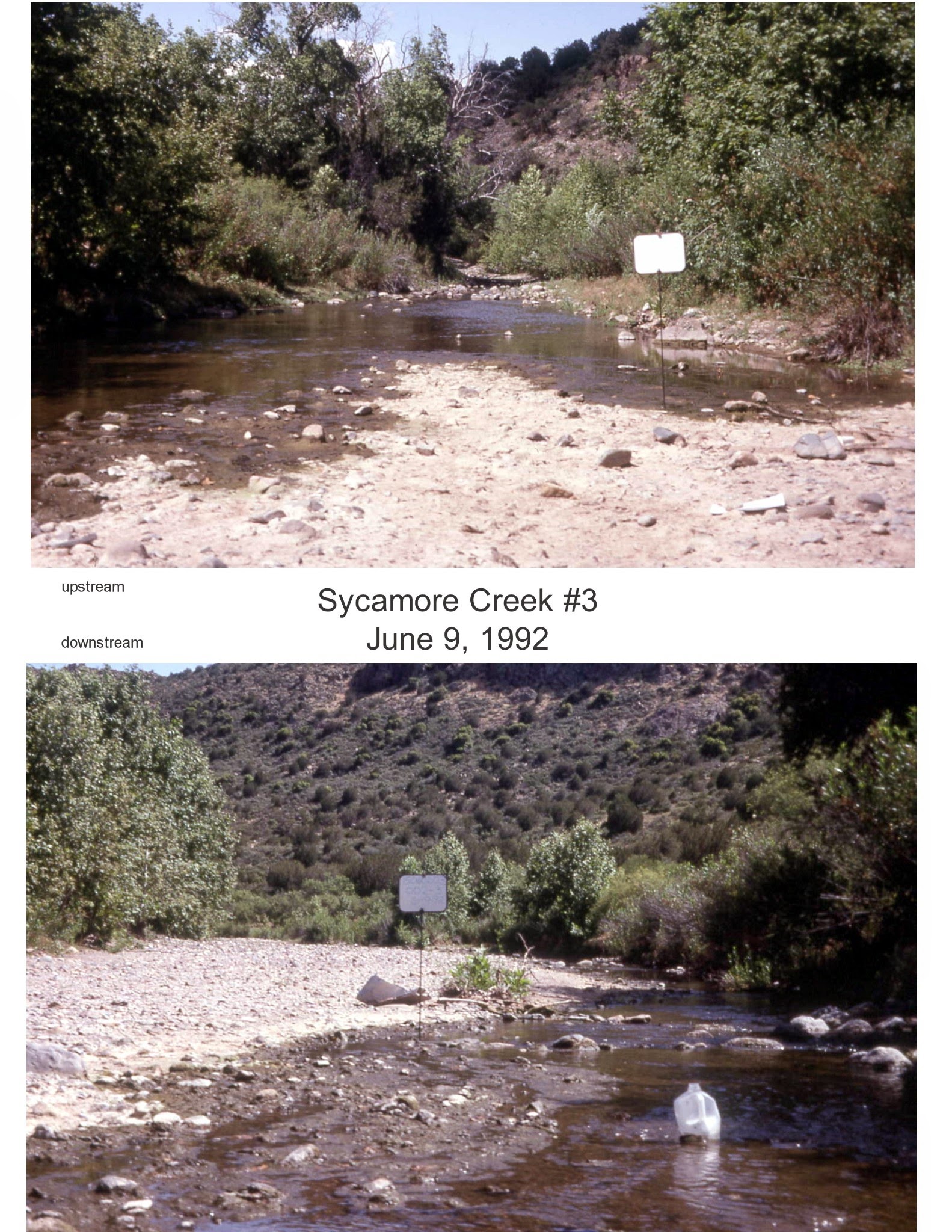
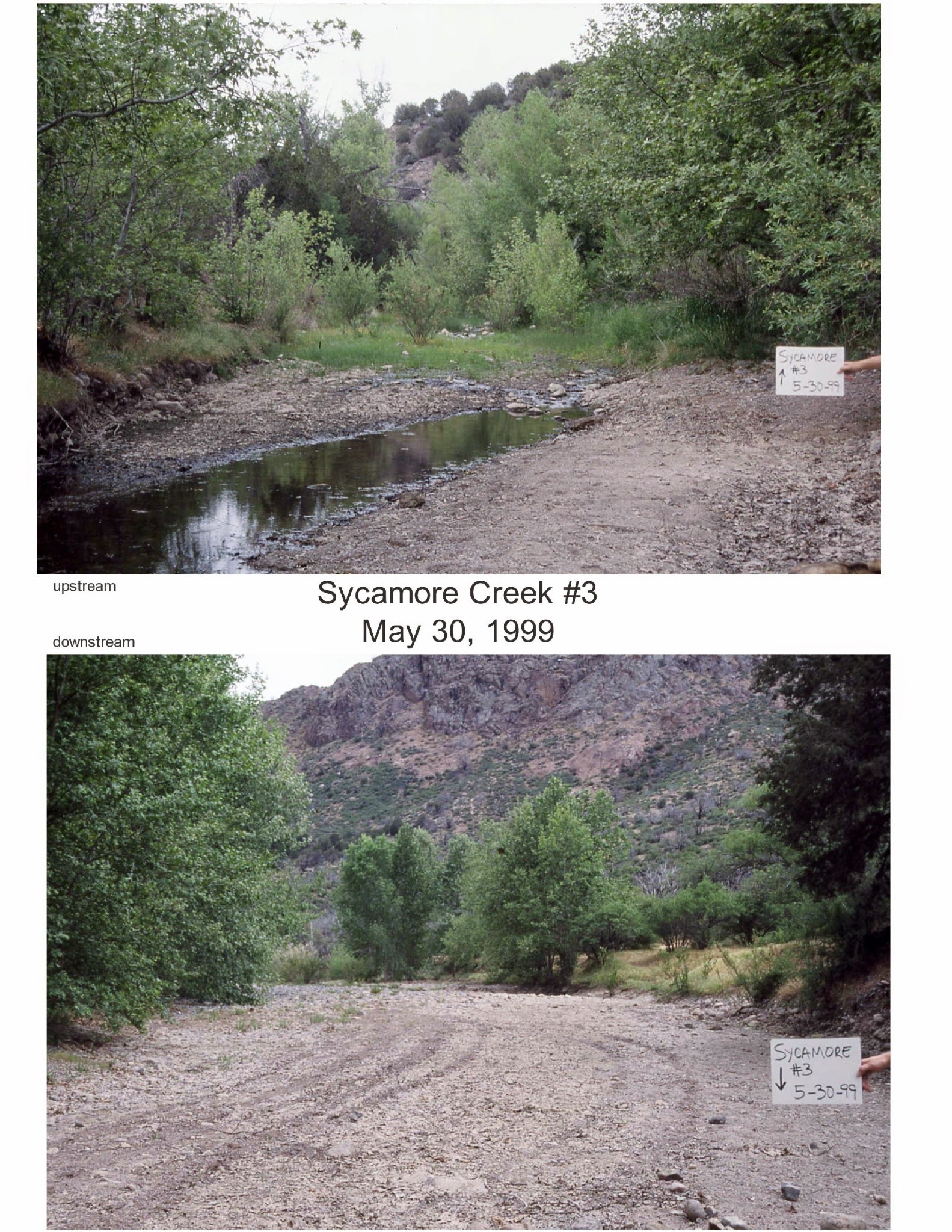
This project has a history of 38 years — the first Riparian Specialist hired by the Tonto National Forest knew the value of repeat photography in documenting resource conditions. He had the foresight to initiate a riparian photopoint program in 1988 — finding important reaches of streamside vegetation and taking clear photographs of the vegetation and streambanks, annually if possible, at the same exact sites each year. The Forest, and ecologists who do research on the Tonto, have come to depend upon information these photos provide – impacts by livestock, or improvement in conditions through livestock management, wildlife impacts, results of flooding, fire and drought. These photos provide documentation of resource conditions, which is used for natural resource management decisions. While data is important, it’s true that nothing tells a story like a good photograph.
Why do the Riparian Photopoint Project?
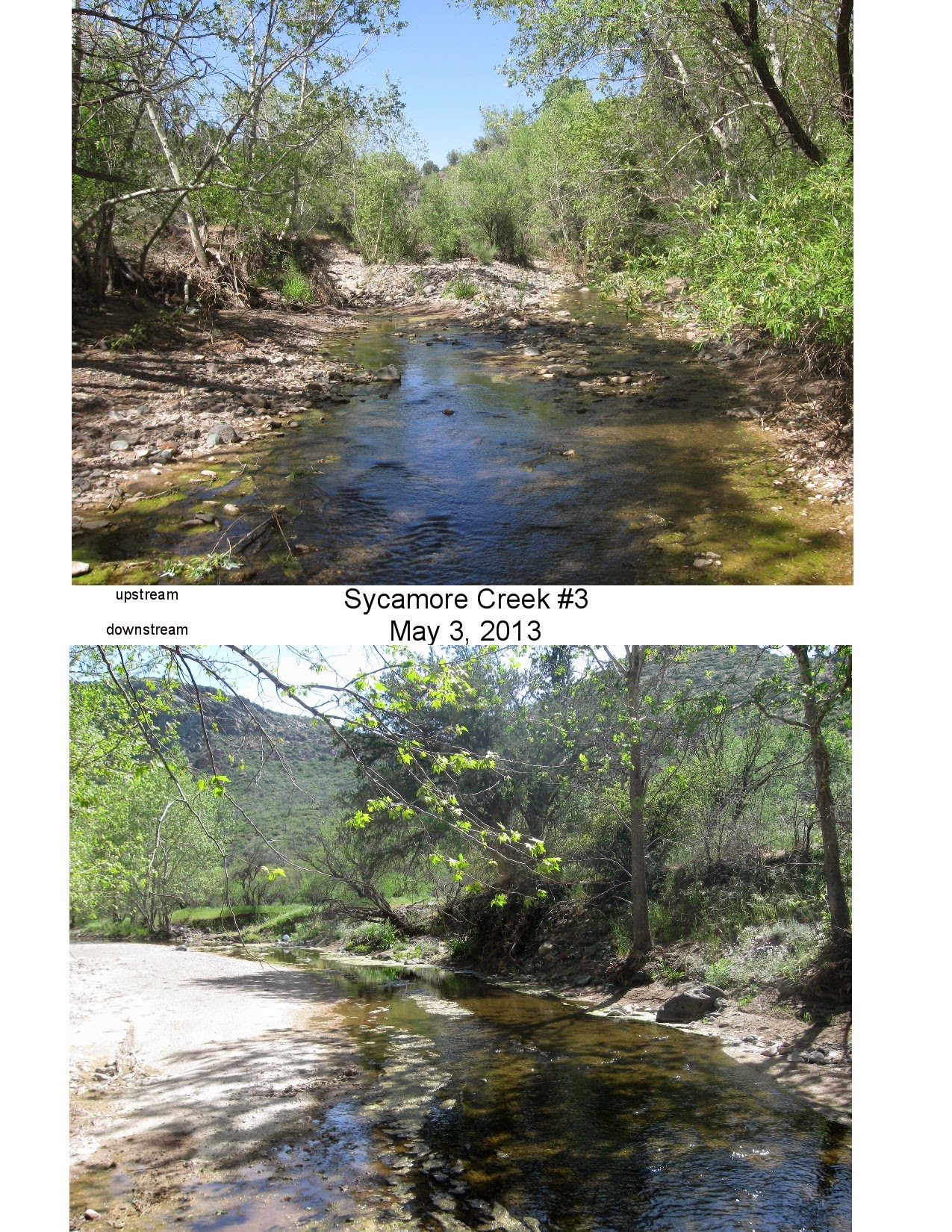
Here’s what Tonto National Forest Resource Managers say about the importance of the photographs.
The program grew under succeeding riparian specialists, and a group called “Mothers for Clean Waters” led by Kathy Nelson, to over 900 sites photographed by an outstanding group of volunteer photographers who enjoy regular visits to their stream sites.
The riparian photopoint program is now run by Friends of the Tonto National Forest, in cooperation with the Tonto. We are continuing the program with the same attention to quality that riparian specialists and long-time volunteers on the Forest have had. Under Friends of the Tonto’s management, the photopoint map and associated photos have been made available for the public to see – check out the interactive map on our website! New photos are added to it each year.
Looking for Volunteers
“You must attend the training and be registered to be considered a volunteer and covered under this program.”
Photopoint season is from mid-April to the end of September. And we need volunteers! You don’t need a special camera, you can use your smartphone. You don’t need a GPS unit – most smartphones can have apps that will read out GPS coordinates. You don’t need a four-wheel drive vehicle (although you do need it for some sites). If you like to get out, or if you need a good excuse to get out – here’s your opportunity!
Training Sessions
The 2026 photopoint season will begin in March 2026, with online, live training sessions. Training for new volunteers will cover why and how we do this, as well as some safety related information. The session will last about an hour and a half. Training for experienced volunteers will have more of a discussion format and will be a little shorter – maybe one hour. There will be two dates for new volunteers and two for experienced volunteers. Training dates have now been added to the event calendar. You can access the registration form by clicking on any of the training dates. Looking forward to seeing you on Zoom!
Selecting Photopoint Sites
2026 List of Priority Photopoint Sites
This is a complete listing of sites with priorities shown. We always aim to photograph all priority sites, but all other sites are also available.
We have recently changed the way photos are displayed. With the new way of displaying them, photos are displayed horizontally by descending date, with upstream photos displayed in one row, downstream photos in another, etc. This makes it much easier to compare photos year to year.
To use the photopoint maps, select a site from either dropdown menu – the one on the right or the one on the top left. The one on the right will bring up site information, the archived photos for the site, and a topo map. The one on the top left will display site information and will highlight the site on the map, allowing you to zoom in to see the roads and the topography near the site.
Notes about the list of sites
The list of sites may seem overwhelming at first (there are over 900 individual sites), but knowing these things will help you a lot:
- Priority sites are highlighted in red. These are the ones that Tonto employees who use the photos and information we gather have determined they need the most.
- Sites highlighted in grey are those the Tonto will be doing. Don’t sign up for those.
- Sites we would like to have done but were not highest priority are highlighted in green.
- Any other site may also be done.
- The tabs on the bottom of the spreadsheet are Ranger Districts. The name of each gives you a general idea what part of the Forest those sites are on. It’s a big Forest!
- You will notice there are groups of sites, ranging from just one to 22. They are grouped in bunches that logically go together. Sometimes you can do them all in one day, sometimes not.
After we receive your registration, we’ll send you an invitation to the Zoom training session you selected.
You can select your sites before or after the training. Or send us a note and we’ll call you back to discuss and figure it out. We can make suggestions of good sites for you, based upon the vehicle you will be using and your hiking preferences. If you’re a previous volunteer who’s been doing certain sites routinely, of course you will have priority for those sites.
IMPORTANT! Riparian Photopoint Job Hazard Analysis
Getting and Returning Your Packet
After we’ve confirmed your site assignment, we’ll deliver your packet/s, either by leaving them on your doorstep, or mailing them. When you’ve finished taking and filing your photos, same thing — we’ll either pick them up or send you an addressed, postage-paid paper you can tape on the packet and pop it into any mailbox.
The weather’s beautiful, the Forest is too, and we’re ready to go out and enjoy it! Hope to hear from you.
The Friends of the Tonto Photopoint team – Patti, Jerry, and Tim